
Trace White Plains Street Records
For a named street, start with one complete address and make a separate record for every parcel checked. The City assessment roll and tax inquiry identify the parcel and the owner as assessed. The County map adds the parcel's physical setting. A deed then documents a recorded transfer, while historic address directories supply a dated reference point. That order matters because assessment ownership, a mailing line, deed title, and residency answer different questions.
- Find the address in the City tax inquiry or annual assessment roll. Save the tax-map parcel ID, assessed owner, property address, deed book/page if shown, and the roll year.
- Enter the resulting address, SBL, or Print Key in the County Property Viewer. Confirm the municipality and parcel before using the map as a block reference.
- Use the deed book/page or current owner as a grantee lead in Westchester Records Online. Record the instrument date, grantor, grantee, legal description, and any prior transfer reference.
- For a historical household question, check White Plains Public Library directories. Reverse address searching begins with the documented 1930 material, so earlier years need name sections and map or deed context.
- Keep voter information out of a street-browsing workflow. New York's tool is a personal registration and poll-site check, not a street list, and voter-registration data has an elections-purpose limit.
When the address shifts from a whole street question to one exact parcel, the evidence becomes clearer. It also becomes easier to see where the record trail stops. The property and deed chain can document a parcel relationship without establishing who is presently inside the building.
White Plains Street Tax Inputs
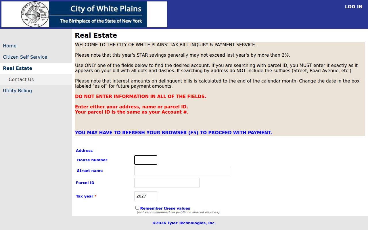
The City Finance inquiry is the practical starting point for a White Plains street directory search. It accepts one route at a time. For an address, pair the house number with the street name and omit the suffix, such as Street, Road, or Avenue. The name route and parcel route are alternatives, not extra filters to fill together. A parcel ID must retain the dots and dashes printed on the tax bill, and the tax year is required.
| City tax inquiry field | How to use it |
|---|---|
| House number | Use with the street-name route. |
| Street name | Leave out the road-type suffix. |
| Name | Use as one alternative search path. |
| Parcel ID | Enter exactly as the tax bill prints it, including dots and dashes. |
| Tax year | Required by the inquiry interface. |
The White Plains tax-bill inquiry shows the address, owner-name, parcel-ID, and tax-year choices that begin the address trail.
Use the resulting account as an assessment clue, then compare it with the roll and recorded deed. A billing name or owner mailing address is not proof of present residence at the property.
Note: City tax material is strongest for the assessed parcel and tax account, while a deed remains the recorded transfer source.
Map White Plains Street Parcels
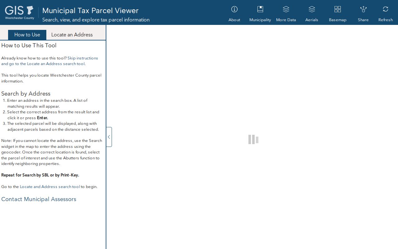
The newer County Property Viewer gives White Plains address work a different kind of precision. Its inspected interface supports partial matches by Address, SBL, and Print Key, plus a map geocoder. It does not offer an owner-name, ZIP, or whole-street filter in that interface. Search a particular address or parcel key, select the parcel, and use the visible municipal and location fields to confirm the map result before moving to another record.
| Property Viewer entry | Format and limit |
|---|---|
| Address | Partial match against PARCEL_ADDR. |
| SBL | Parcel identifier search. |
| Print Key | Parcel-key search. |
| Map geocoder | Location-based entry point. |
| Owner, ZIP, whole street | Not exposed as filters in the inspected viewer. |
The County Property Viewer displays the Address, SBL, Print Key, and map tools available for a White Plains street parcel.
The map is useful for parcel geography and nearby features. It is informational, not a legal survey, and municipal assessors maintain the authoritative tax maps.
White Plains Street Record Coverage
Address evidence in White Plains is distributed by custodian. The City roll is better for assessed owner and mailing lines; the County map provides parcel context; the Clerk records land instruments; and the Library keeps the historical directory route. Reading those as a chain avoids the common mistake of treating one display field as a complete account of a household.
| Address record | Custodian | What it can establish | Access route |
|---|---|---|---|
| Assessment roll | White Plains Assessor | Assessed owner, mailing line, parcel, value, exemption, deed clue | Assessor roll and office |
| Tax account | City Finance | Address, name, or parcel-linked tax account | City tax inquiry |
| Parcel map | Westchester County | Location, SBL, Print Key, municipal and map context | County Property Viewer |
| Land instrument | County Clerk | Grantor, grantee, legal description, recording reference | WRO or Land Records |
| Older deed index | County Archives | Historic grantor/grantee and estate leads | Archives mail research |
| Permit file | City Building Department | Defined project or status material, if releasable | Department request or FOIL |
For city geography, use the Assessor's parcel material rather than a postal label. For transfer history, use the Clerk record. The records are complementary, but they do not convert a tax or deed result into a roster of people on a street.
White Plains Street SBL Terms
Parcel language is worth decoding before a street directory search goes farther. A single parcel can have a physical address, an owner correspondence address, and a legal identifier. Recording each one separately makes later roll, map, and deed comparisons much more reliable.
- Parcel
- A taxable unit of land shown in the assessment and mapping systems.
- Situs address
- The physical property address, which can differ from where the owner receives mail.
- SBL
- The section, block, and lot style tax-map identifier used to connect a parcel to City and County records.
- Print Key
- A parcel key displayed by the County Property Viewer and useful for checking the selected map record.
The published City roll also includes a deed book/page clue, property class, assessment values, exemption codes, district fields, and owner mailing information. Each is an administrative record field, not a statement about all persons connected with the location.
Note: Write the roll year beside every SBL, deed reference, and mailing line so later comparisons do not merge records from different dates.
White Plains Street Deed Records
A deed trail starts after the parcel is identified. Take the SBL or tax-map number, legal description, deed book/page, and present assessed owner from the City material. In Westchester Records Online, search land records for the owner as grantee or for the known book/page. The instrument can identify the grantor, the grantee, recording reference, and legal description. Follow the former grantor or matching legal description to test the preceding transfer.
WRO has a free index described by the Clerk, but the unauthenticated gateway did not expose its live filters. Licensed remote access is a separate layer. The practical alternatives are the free public search and image terminals in Land Records Room 345, the Land Records counter, or a mail copy request that includes document type, owner, property address, approximate date, and known liber/page or control number. Earlier transfers can move to the County Archives, whose deed grantor/grantee indexes cover 1680 through 1907.
That sequence follows recorded title. It should not be used to claim an uninterrupted household history. Grantor and grantee describe a recorded transaction, while an assessment mailing line describes the tax record.
White Plains Street Name Changes
White Plains has a documented street-name quirk that matters when comparing an old directory or deed with a current map. City history identifies Railroad Avenue as Main Street and Village Street as Broadway. A historical address may therefore be filed under the earlier name even when a modern search uses the newer one. The right bridge is an SBL, legal description, filed map, adjacent cross street, or deed reference, not a guess from the name alone.
No verified Citywide house-number renumbering crosswalk was located. Treat an apparent number mismatch as a research problem: check the record date, the old map label, the legal description, and nearby intersections before deciding that two entries concern the same property. Historic maps and the County's digital collections can support that comparison, but they do not impose a modern parcel boundary on an older record.
Note: Railroad Avenue and Village Street are documented aliases; other apparent street-name changes need a source-specific map, deed, or directory check.
White Plains Street Building Files
Building material can date a project, describe proposed work, or identify the parties named in a particular application. It is not a public history search for everyone at an address. The Building Department is at 70 Church Street, and its published route calls for complete, notarized applications brought in person. New applications and plan-review consultations are accepted on weekdays from 9 a.m. to 1 p.m.
For an existing record, make a defined request. Give the site address or SBL, time period, permit or case type, and the permit card, inspection, plan, or other item sought. The City FOIL process accepts requests by mail, fax, or personal delivery and requires a reasonable record description. Its form distinguishes inspection from copies. The open-permit-status form is a return-to-inspector status request, not a public database of historical building files.
City FOIL says ordinary copies up to 9 by 14 inches are $0.25 per page, with additional published charges for large plans, postage, and qualifying electronic preparation. Confirm the current department route and fee before ordering.
Use White Plains Reverse Directories
The historical address layer belongs at White Plains Public Library, not in the modern parcel viewer. The Library's House History guidance reports a directory run from 1888 to 1967 with gaps and says reverse lookups begin in 1930. A reverse directory works from an address toward a dated entry. Before 1930, use the name sections, maps, assessment/deed material, and nearby references rather than expecting an address index.
The WPPL House History guide recommends a practical sequence of directory, map or atlas, assessment or deed, and newspapers or census. Directories are not completely authoritative, so transcribe spelling and abbreviations as printed and compare the date against the underlying record. Historical directory collections are treated in depth in the White Plains city directory material.
For a past-street question, that dated sequence is more defensible than projecting the current assessment roll backward. It also respects the difference between a directory entry and a present-day residence claim.
White Plains Street Source Years
White Plains address records do not all describe the same moment. The City final assessment roll is a 2026 source, while a checked County Property Viewer parcel sample returned 2025 roll and spatial years. A County ArcGIS parcel-layer technical record identifies 2023 tax-parcel geography. Each can be useful, but the year needs to travel with the fact being used.
That comparison prevents a subtle error: treating a current-looking map screen as proof that its owner or parcel data matches the City roll. Cite the City roll for its assessment year, the viewer for its displayed year, and the deed for its recording date. If the records conflict, ask the relevant custodian rather than blending them into one account.
Note: Source dates are part of the record evidence, especially where assessment, map, and recorded-transfer systems update on different schedules.
White Plains Street Voter Limits
New York's voter service asks for county, last name, first name, date of birth, and ZIP code so a registered voter can check personal registration, poll-site, or ballot information. It cannot be browsed by street. Selecting Westchester and entering a White Plains mailing ZIP does not create a public block directory.
Election Law section 3-103(5) limits voter-registration information to an elections purpose. The Westchester Board of Elections can receive a focused records request, but its form does not erase that statutory rule. Qualifying confidential voters may also have their registrations kept separate from public inspection. Keep street research with parcel, deed, and historical-directory records, and use election channels only for their stated purpose.
White Plains Street Directory Limits
A White Plains street directory can connect address-keyed public records, but it cannot reveal every resident of a property. An assessed owner may receive mail elsewhere. A deed names transaction parties, not all occupants. The City tax inquiry and County map have separate update dates and purposes. Missing, blank, redacted, or substitute address material can reflect a legal protection rather than a gap to reconstruct.
New York's Address Confidentiality Program and confidential-voter procedures protect qualifying people. Vital records have their own access rules. Stop when an official source omits protected information, and verify consequential property facts with the Assessor, County Clerk, or other custodian that made the record.
Lawful use. Use White Plains address records for legitimate personal, family-history, estate, civic, or safety questions. Do not use them to stalk, harass, intimidate, or pursue a protected person.